Electoral Maps Booklet
In this PDF booklet you can find visual depiction of various electoral modifications made since 1990. These include the so-called “special sub-constituency system”, the 1996 case of gerrymandering and various electoral systems used for federal elections. Booklet also contains demographic data from official sources.
Electoral maps presented in this booklet are based on official data and were made using a combination of advanced software applications for design and publishing.

Time period covered: 1990 – 2025
Last update: July 2025
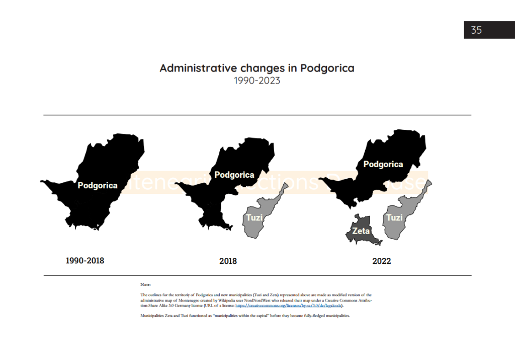
In the latest update, among other interesting data, I present the map of Montenegro with ethnic affiliation based on 2023 census data, as well as some interesting details about the recent changes in administrative borders of the municipality of Podgorica which might be of interest to some scholars.
The latest maps are made by modifying the administrative map of Montenegro created by NordNordWest, published under the Creative Commons Attribution – Share Alike 3.0 Germany license (URL of a license: https://creativecommons.org/licenses/by-sa/3.0/de/legalcode).